By Michael Lanza
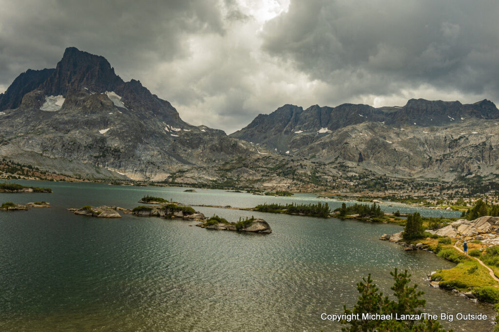
All day, clouds the color of a bruise pile up across the sky, conceding the sun only brief, teasing appearances before blocking it out again. Carrying packs bursting with nine days of food, we hike past lakes, each one higher and prettier than the last. More than seven miles from where we began our walk, we stroll into the basin of a sprawling lake whose image captured in historic Ansel Adams photographs has in many ways come to define the public’s mental picture of what is arguably America’s finest mountain range, the High Sierra: Speckled by scores of rocky islets below the distinctive profile of aptly named Banner Peak, Thousand Island Lake today bares whitecapped teeth pushed up by strong gusts of wind.
We cross the John Muir Trail—which we’ll rejoin farther south in a couple of days—and pick up a use trail tracing the north shore of Thousand Island Lake. Not long after that path disappears into the rocky ground, we find a campsite semi-protected from the buffeting wind by a copse of stunted conifer trees, a couple minutes’ walk from the lake’s southwest corner, at just under 10,000 feet in the shadow of Banner Peak.

That evening, the clouds begin to fragment like river ice in spring, scurrying past us. As the sun hovers above mountains to our west and eventually tucks in behind them, its light streams over the bellies of the clouds floating past at greatly varying altitudes—some low, some very high, others in between the lowest and highest clouds. The combination of rays of sunlight at the red end of the spectrum and multiple levels of clouds, mixed with patches of deep blue, creates a skyscape that shifts its colors every few seconds and a nearly hour-long spectacle of one of the most striking sunsets I have ever witnessed.
John Muir certainly had it right when he called the High Sierra “the range of light.”
After dark falls and we tuck into our tents, we hear the wind gather itself in some unknown place high above us. Over slow minutes, it builds in volume until crashing with a roar through our camp in a tsunami of air that seems to shake the earth for long, tent-flapping seconds. After passing by, it leaves us in a quiet calm that rarely lasts more than a minute or two before the next great gust builds and barrels into us. This continues throughout the night.

My longtime adventure partner David Ports, my 24-year-old nephew Marco Garofalo, and I have embarked on a nine-day trek of nearly 130 miles that will rival the very best High Sierra backpacking trips I’ve ever taken—including my thru-hike of the John Muir Trail.
Hiking barely more than half the usual distance of a full JMT thru-hike, we’re following an itinerary I created—which could be hiked in shorter pieces (see details in the trip planning information at the bottom of this story, available exclusively to paid subscribers to this blog)—that takes us into the Ansel Adams and John Muir Wildernesses and Kings Canyon National Park, exploring gorgeous high lakes basins, crossing passes that scrape the stratosphere at 11,000 to 12,000 feet, hiking some off-trail terrain and traversing one of the finest sections of the John Muir Trail.
I’ve been dreaming about this hike for months.
See “10 Great John Muir Trail Section Hikes.”


The Minarets
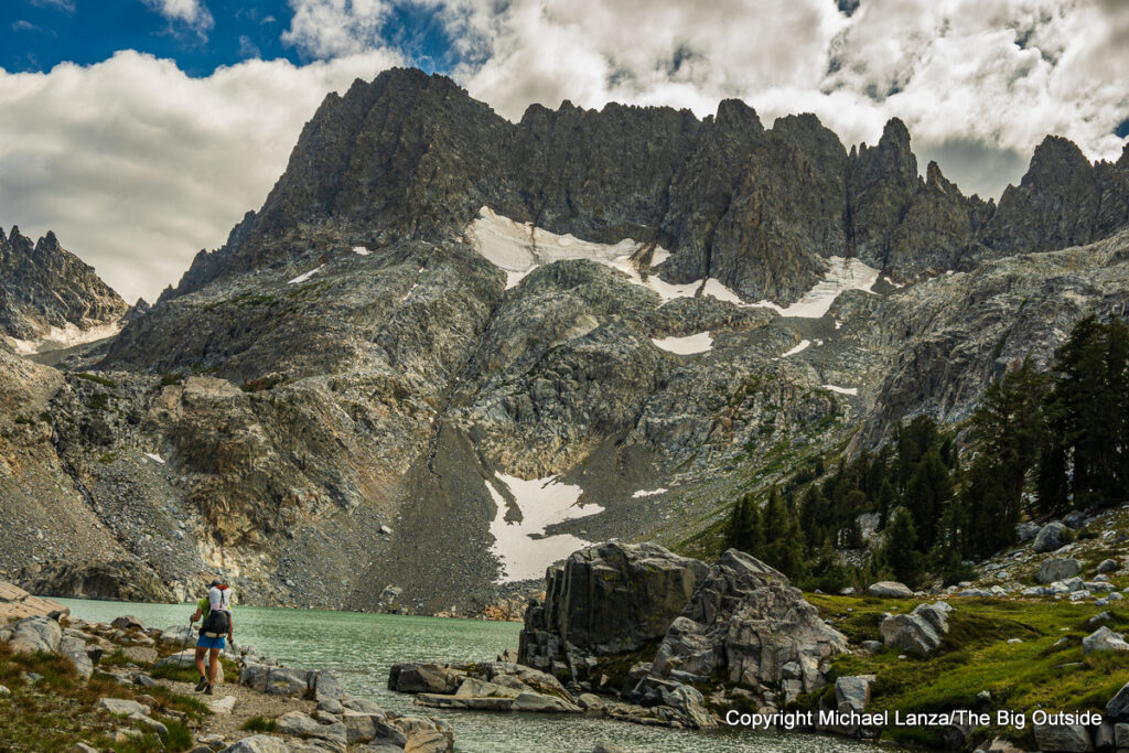
On our second morning, we hike cross-country south from Thousand Island Lake over a couple of passes above 10,000 feet and a couple of lakes basins, finally descending to the wind-rippled, brown waters of Ediza Lake at nearly 9,300 feet. There, we pick up a trail—with Marco flying ahead of David and me going uphill—ascending steeply to stunning Iceberg Lake at almost 9,800 feet. Tucked up hard against cliffs, Iceberg sits below a few of the well over a dozen 11,000- and 12,000-foot spires known as the Minarets, lined up like chipped and broken bowling pins.
And we’re not done climbing. From Iceberg, we follow an improbable, strenuously steep and rough trail of sorts across a slope of talus and scree angling upward around Iceberg to Cecile Lake, at 10,260 feet in another rocky bowl at the feet of the Minarets. With any semblance of a trail terminating there, we poke around to find a route across yet more talus and drop down a steep, narrow gully to aptly named Minaret Lake—arguably the prettiest lake we’ve seen today. We hike past at least a few other parties camped here, finding a spot for our tents amid conifer trees a short walk from the lakeshore for water and far enough from other backpackers that we see no one else all evening and the next morning.
Like what you’re reading? Sign up now for my FREE email newsletter!

Fortunately, the Sierra weather gods are smiling on us. This day had launched with clear, sunny skies and pleasant temperatures—and this weather pattern will persist for six straight days, giving us comfortably cool nights for sleeping, mornings in the forties Fahrenheit and afternoons at elevation in the 60s. In the High Sierra, where between hot temps and the intense alpine sun, afternoons can feel like you’re hiking under a grow lamp, we spend half of our hiking time hardly breaking a sweat.
That evening, we sit on granite rocks watching the full moon rise in the V formed by the valley of Minaret Creek below us; and the next morning, our third, dawn light sets the Minarets glowing like the embers of a well-tended fire, reflected in the slightly rippling waters of Minaret Lake.


Marie Lake and Sallie Keyes Lakes
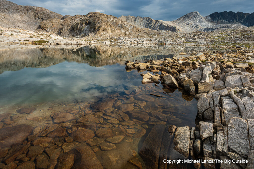
On yet another calm, clear day with comfortable temps and a blazing sun, we walk up to the shore of one of the most beautiful water bodies on the JMT: Marie Lake. A sort of downsized Thousand Island Lake, Marie spreads out like a spilt drink in a basin at over 10,500 feet. Numerous islands, large and small, speckle its surface and peninsulas jut into it from all sides. We drop our packs on granite slabs, strip off sweaty T-shirts and shorts, and plunge into the chilly but refreshing water, enduring the cold for just a few minutes, and sit in the sun to dry off and warm up—with the cool breeze aiding the former and slightly hindering the latter—followed by a long, relaxing lunch break.
It’s our sixth afternoon and, with lighter packs as we burn through our food weight, we’ve hit our stride, coming off back-to-back days of around 17 miles, one with over 5,000 feet of cumulative uphill and downhill, the other over 8,000 feet. (Marco again sets a pace impossible for David and me—both the age of Marco’s dad—to maintain, blasting ahead and waiting for us at trail junctions or lakes, where we’ll arrive to see he’s already taken a swim. When we see a white-bearded backpacker coming down the trail toward us, I ask him, “Did you see the young guy cranking uphill?” He quickly responds, “Yea, cranking up! It just ain’t fair.” To which I agree and David nods with resignation.)
I can help you plan this or any trip you read about at my blog. Click here to learn how.

And the JMT has rewarded our efforts with scenery that acts as a balm for sore muscles and joints—the regular percussion of countless waterfalls and cascades, a constellation of lakes, and views of a sea of jagged mountains from high passes.
But the finest scenery of this trip still awaits us.
After our rejuvenating swim and lunch, we make the relatively easy climb over Selden Pass at 10,880 feet and drop to the lovely Sallie Keyes Lakes, twins wrapped in open forest at 10,170 feet, finding a protected site for our tents a short walk from the lakeshore—where we take another brief swim and will enjoy another gorgeous sunrise tomorrow morning.
Plan your next great backpacking adventure in Yosemite and other flagship parks using my expert e-guides.


Evolution Basin and Muir Pass
In the cool air of our eighth morning, we ascend the JMT out of Goddard Canyon, passing the thunderous waterfalls and steep cascades on Evolution Creek and pulling our shoes and socks off to ford the frigid creek at a flat, wide, and slow spot. Hiking up the gentle, forested Evolution Valley, we step off the trail at an established campsite where the creek widens and slows in a broad meadow, its calm waters reflecting the puffy clouds and peaks across the valley. Minutes later, at the ranger station, the ranger tells us the perfect weather we’ve been experiencing for a week is about to shift to a cycle of afternoon thunderstorms—with a pretty good chance of one later this afternoon.
The forest thins as we ascend switchbacks above the valley. Granite cliffs come into view on both sides and ahead of us. Abruptly, the waters of another JMT gem appear in front of us: Evolution Lake. If you’re fairly new to the southern High Sierra, walking up to Evolution Lake requires the brain to recalibrate your sense of scale. We have reached one of the JMT sections—and there are several—that earn it the nickname “America’s most beautiful trail.”
Join now to read all of this story, including my expert tips on planning this trip, and ALL stories at The Big Outside, plus get a FREE e-guide and gear discounts!
We follow the JMT’s easy, meandering course through meadows around the contours of the lake, which stretches a mile or more up Evolution Basin, passing other backpackers and a few tents already set up in early afternoon. Cliffs soar to tall peaks on all sides, including the 13,000-footers Mounts Mendel and Darwin and the 12,329-foot Hermit. Little clusters of small conifer trees offer some protection for camping; but as we climb farther up the Evolution Basin, where the trail ascends the rocky slope above Sapphire Lake, the wide-open terrain offers no such protection.
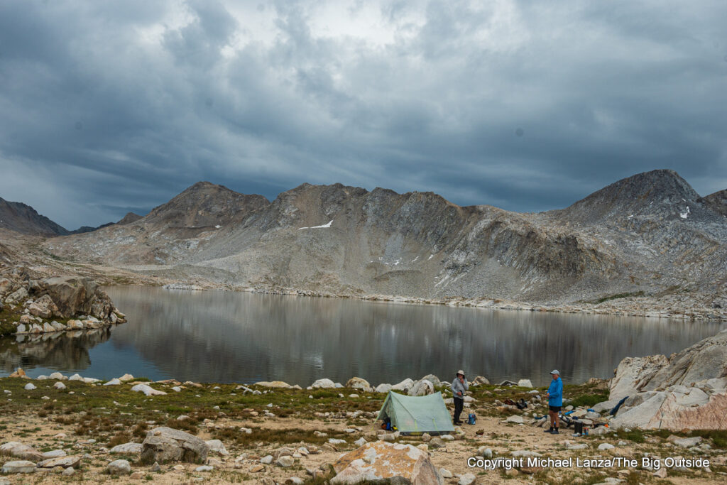
As the ranger foretold, dark storm clouds mass above the upper basin, moving toward us. When the wind-driven rain and hail begin, we find a couple of large boulders off the trail and hunker down on the ground in their lee, avoiding some of the precipitation and most of the wind. But the storm apparently has no intention of just blowing over quickly. We retreat to lower ground in the basin, just above Evolution Lake, hurriedly pitch the tents and crawl inside, inflating our air mats and slipping inside our sleeping bags for warmth to wait it out. More than an hour after the storm began, it dissipates; we unzip tent doors to see sunshine and mostly blue sky again in the direction we’re going, although the storm remains very dark over Evolution Lake.
Want to hike the John Muir Trail?
Click here for expert, detailed advice you won’t get elsewhere.

See all stories about backpacking the John Muir Trail and backpacking in the High Sierra and all stories with expert backpacking tips at The Big Outside.
The Gear I Used See my reviews of the outstanding backpack, tent, sleeping bag, down jacket, ultralight rain jacket, hiking pants, air mattress, stove, and headlamp I used on this trip.
See also my Gear Reviews page for best-in-category reviews and expert buying tips.
Whether you’re a beginner or seasoned backpacker, you’ll learn new tricks for making all of your trips go better in my “How to Plan a Backpacking Trip—12 Expert Tips,” “A Practical Guide to Lightweight and Ultralight Backpacking,” and “How to Know How Hard a Hike Will Be.” With a paid subscription to The Big Outside, you can read all of those three stories for free; if you don’t have a subscription, you can download the e-guide versions of “12 Expert Tips for Planning a Backpacking Trip,” the lightweight and ultralight backpacking guide, and “How to Know How Hard a Hike Will Be.”

 Hi, I’m Michael Lanza, creator of The Big Outside.