By Michael Lanza
We’ve hiked just over three miles into a four-day backpacking trip in Idaho’s Sawtooth Mountains when my wife, Penny, and I cross yet another rock-strewn valley meadow below craggy cliffs of shattered granite, enter the cool shade of forest, and come to a stop. The very obvious trail we’ve been following has abruptly disappeared—exactly as we expected, because our map shows this trail terminating here. End of the road.
But not really.
Moments later, our friends Todd Arndt and Mark Fenton catch up; and after only a few minutes of poking around, we locate the unofficial “social” or “use” trail we expected to find. It appears on no map and certainly sees very little human traffic. But over the years, enough intrepid Sawtooth backpackers, anglers, hunters, and others have hiked this route to create a mostly visible path leading up into a high valley of lakes and, at its head, a mountain cirque that few people ever set eyes on.
The four of us will be the next ones to see it.
 Hi, I’m Michael Lanza, creator of The Big Outside. Click here to sign up for my FREE email newsletter. Join The Big Outside to get full access to all of my blog’s stories. Click here for my e-guides to classic backpacking trips. Click here to learn how I can help you plan your next trip.

Our timing seems perfect: It’s a beautiful day in the middle of August, with afternoon highs hovering in the low seventies Fahrenheit and a gentle, cooling breeze—a mild and dry weather pattern that will persist throughout our four-day hike.
And we started from a trailhead that, while easily accessible, draws a far smaller number of dayhikers and backpackers than the few popular Sawtooth trailheads. The first good omen was seeing just two other cars in the trailhead parking lot. That’s also a benefit of starting on a Monday—even in August.
Our unofficial trail rises somewhat steeply at first, but before long levels to a much gentler angle. We alternately walk through shady forest and open meadows of grass and wildflowers below jagged ridgelines and cliffs scarred with cracks—rock faces lined with age that are so characteristic of the Sawtooths, where I’ve backpacked, taken long dayhikes and runs and climbed peaks for almost three decades.
Like what you’re reading? Sign up now for my FREE email newsletter!

Most conspicuously, we encounter no other people on this unmapped path. In fact, it functions as both an appropriate introduction to and scene-setter for this trip. We’ll hike for four days, crossing five passes—four of them on our biggest day, which still stays under 12 miles and 3,000 feet of elevation gain—camp beside a gorgeous lake every night and walk past many others, and hit some of the best scenery in the heart of the Sawtooths during a stretch of perfect weather in August very few other people.
By late afternoon, we walk into an established campsite beside a pretty little unnamed lake at about 8,500 feet (an elevation similar to many Sawtooth mountain lakes) tucked into the tight embrace of forest and short cliffs that drop straight into the calm water—which, in mid-August, has reached an ideal temperature for a quick dip. We notice one solo backpacker camping perhaps 200 yards from us. Besides him, we’ve seen only two dayhikers and two backpackers today, all of them close to the trailhead and on their way to it.
See “12 Expert Tips For Finding Solitude While Backpacking”
and “Big Scenery, No Crowds: 15 Top Backpacking Trips for Solitude.”


An Unnamed Pass at 9,500 Feet
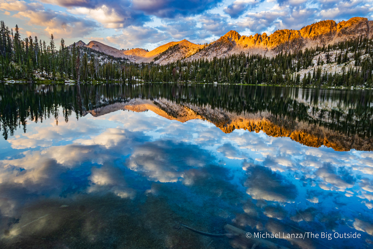
On our second morning, after a sunrise that slowly dripped golden light down the high rock faces surrounding us and, as a finale, lit up the trees hugging the shore across the lake—the entire, slowly unfolding drama reflected in the mirror-like water—we leave camp a bit after 9 a.m., following what is still a good use trail up the forested valley. It grows a bit circuitous and obscure in just a few spots and ascends one gully that’s steep but not terribly loose. But the route remains mostly visible until we reach the head of the valley.
We emerge from the forest at the highest lake in a cirque with another sizable lake—both unnamed and looking like beautiful spots to camp—and traverse a low-angle granite slab rising out of the water’s edge to reach the lake’s far side. There, we pause in a meadow of wildflowers. Granite faces and peaks rising to over 9,000 and 10,000 feet form a formidable wall ahead of us, a barrier with one relatively friendly-looking break in it: a pass at over 9,000 feet. We beeline toward broad, zigzagging ramps that offer a steep but walkable route to the pass.
Join The Big Outside now to see this trip’s daily itinerary
and get full access to ALL stories at this blog.

After a steady but short uphill grind, we top out at the pass, at around 9,550 feet (our trip’s high point, not including the 10,000-foot peak Todd and I will scramble tomorrow), and enjoy a break in warm sunshine and a delightful breeze. And the 360 from this pass pays off the effort to reach it with extra change to spare.
I gaze back over the green, lake-filled basin we just walked up, and then swivel 180 degrees to scan—scrutinize with mild concern is probably more accurate—the steep, talus- and scree-filled upper basin that we’re about to spend an unusually protracted amount of time walking very carefully across for the next quarter-mile or so downhill. Below that talus, though, lies another basin speckled with a few dozen lakes large and small—only one of which has a name—all nestled within an arc of 10,000-foot peaks.
I’ve helped many readers plan unforgettable backpacking and hiking trips.
Want my help with yours? Click here .

It looks even more spectacular than the valley we just hiked up. But I’m used to that happening on hikes through the Sawtooths—where, on my first handful of backpacking trips, while I was still getting to know the range, I kept seeing new spots that convinced me I had yet again found the most beautiful part of the Sawtooths that I’d ever seen.
And just beyond that lone named body of water shimmering in the bright sunshine ahead of us, we will reach another “real” trail—and remain on trails for the rest of this trip.
Click here now for my expert e-book to
the best backpacking trip in Idaho’s Sawtooth Mountains!
See all stories about backpacking in Idaho’s Sawtooth Mountains at The Big Outside, including “Hiking and Backpacking in Idaho’s Sawtooth Mountains—A Photo Gallery,” “The Best Hikes and Backpacking Trips in Idaho’s Sawtooths,” and “Going After Goals: Backpacking in Idaho’s Sawtooth Mountains,” about an earlier trip that overlapped this one but also went deeper into more remote areas of the range.
See also my expert e-book “The Best Backpacking Trip in Idaho’s Sawtooth Mountains” and my Custom Trip Planning page to learn how I can help you plan your trip in the Sawtooths or any other trip you read about at The Big Outside.
The Gear I Used See reviews of the outstanding backpack, tent, sleeping bag, insulated jacket, trekking poles, air mattress, stove, and headlamp I used on this trip.
Not sure this is for you? See “How to Know How Hard a Hike Will Be,” “How to Plan a Backpacking Trip—12 Expert Tips,” and “5 Questions to Ask Before Trying a New Outdoors Adventure,” and all stories offering expert backpacking tips at The Big Outside.